6 weeks ago on the Trail Verbier St Bernard course I had a very tough time on the climb up to Lac de Fenetre from La Fouly. Although I had 30 less miles on my legs, Friday's climb back up to the same went much better. The Val Ferret in Switzerland is incredibly scenic. Huge big landscapes, glaciated peaks and deeply glaciated valleys. And, of course, egregious amounts vertical. I managed 4100 ft of vertical in 6.5 miles (round trip) on Saturday morning's ascent of La Dotse, much of it at 30-40% grade, which is slightly less than the gradient where one would prefer to put a hand on the slope for help in ascending.

My first run was the incredibly popular ascent to Lac de Fenetre

Headwaters of Le Dranse de Ferret. The high peaks in the background are the CH/IT border

The first Lac de Fenetre and the Col de Fenetre in the background. The Trail de Verbier St Bernard took us over the Col de Fenetre and around the Italian side back to Grand St Bernard Pass
Rather than retracing my steps up to Col de Fenetre I opted for the green dashed line option over to Col de Bastillon. In retrospect the climb up to Col de Fenetre is much nicer.

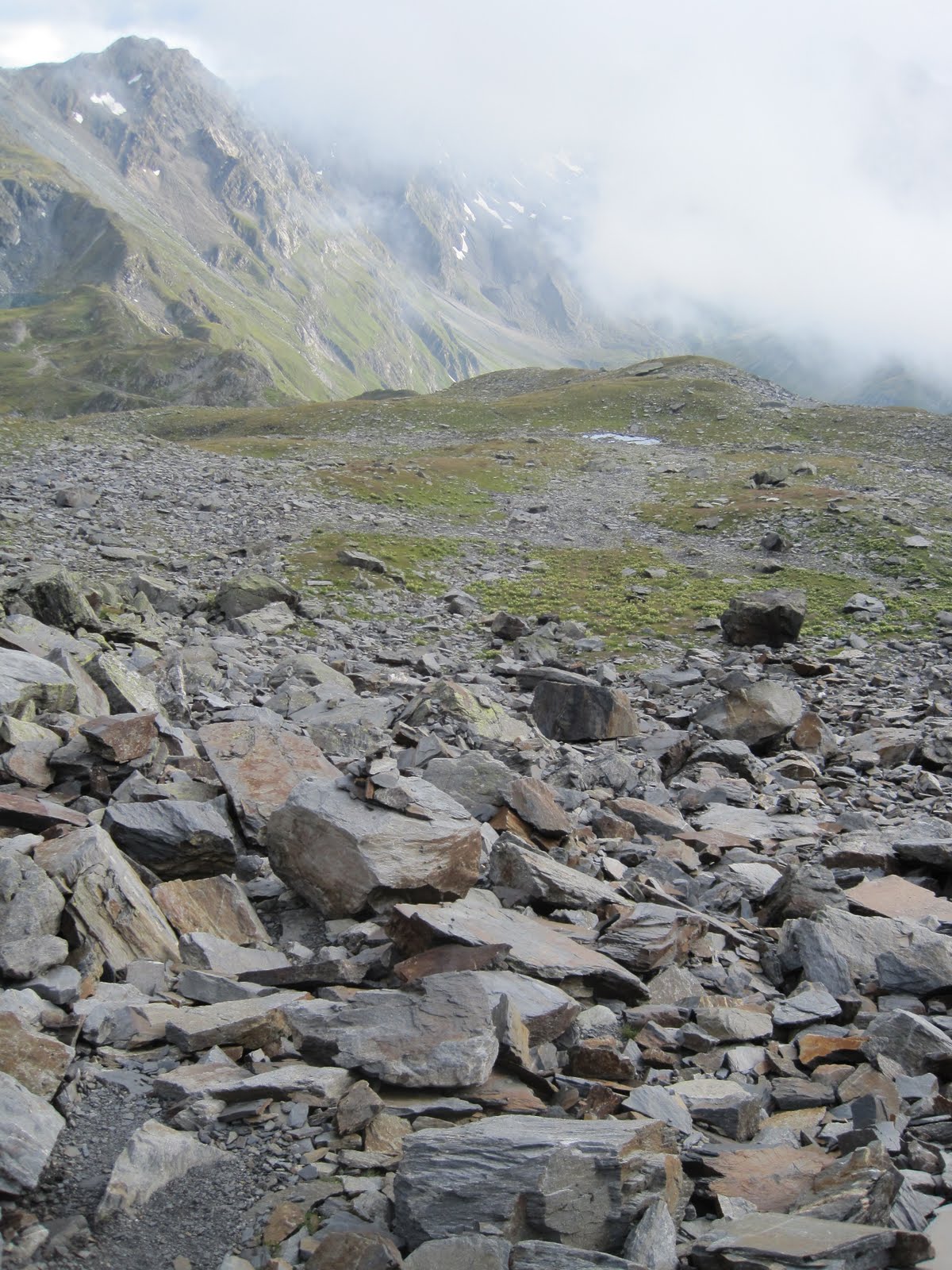
Swiss trail leading up to Col de Bastillon from Lac de Fenetre. Half tread, check. Overly outsloped, check. 40+% grade, check. At least 20m of exposure, check.

Descent from Lac de Fenetre down the upper Val Ferret

Early sunset over Mt Telliers

Saturday's jaunt. Down valley, cross the river and climb up La Dotse

The climb around La Dotse on the Tour du Mont Blanc course. Picture is taken looking back towards the Col de Ferret. Both Italy and Switzerland call the basins emanating from their respective side of this drainage Val Ferret. Les Marmontains on the left, CH/IT border in the background

Mt Dolent is the meeting point of the FR/CH/IT borders

Navigating a gauntlet of electrified fences to achieve the summit of La Dotse. In retrospect the better route would have been the most direct line from La Peule (the Alpage/resto) just below. I traversed/climbed around the backside looking for a route on the back ridgeline and encountered way too many of these.

Edelweiss

Garmin says: 2820 ft of vertical in 5.45 miles (in blue) and 4130 ft of vertical 6.45 miles (in red). Click to enlarge.


No comments:
Post a Comment