12/22/10

2010 year in review

I had planned to run my first 100km in 2010 and a 100 miler in 2011.   Fate intervened when my name got accidentally drawn in the Western States lottery in December 2009.  That wasn’t supposed to happen.  I only entered for the additional ticket a few years down the road.  Snow began on us hiking the the Appalachian Trail in earnest in SW Virginia and thru-hiking became quite a challenge.  Once my Aqua Mira water treatment froze (let alone water) we knew it was time to get off the trail and put on a few well earned comfort pounds for the winter.


Hitching off the Appalachian Trail in SW Virginia in Mid December.

Returning to running felt arduous initially.  I was surprised how hard it was to get my heart rate back up on tempo efforts, but for some strange reason I never properly addressed the lack of early season speed and opted for quantity over quality all spring.

Training for WS I managed to keep myself quite entertained mapping the maze, which anyone who has run the McDonald Forest 50km knows quite intimately.  It turns out that its quite easy to get lost in this forest … and that’s just the way I like it.


While putting together my PhD dissertation I burned off a bit of energy running every real trail and deer trail in the Maze.

I was treated to a spectacular course at the Chuckanut 50km, my first race of the year.  The ridgeline trail in the Chuckanuts is really fun, and April’s mom volunteered at one of aid stations to see what ultrarunning is all about … hungry and smelly people eating bananas and m+m’s at 10 in the morning, right?

Spring arrived (most popular post of the year) in the McDonald forest outside of Corvallis, the Erythronium bloomed, Cardamine shined and as the Snow queens went back to the soil for the year we made the mandatory pilgrimage to the charming Central Oregon Cascades town of Sisters for a jaunt through beautiful Ponderosa Pine forests on the Peterson Ridge Rumble course.  Even though I opted for the short course, I got a good taste of what running on really sore legs would be like.  Training for WS was ramping up, and I wasn’t taking any taper for any races.  The post race burritos at this race were amazing.


Erythroniums in bloom in the McDonald Forest outside of Corvallis, OR in May

I continued to increase my weekly volume and used Capitol Peak 50 miler as a tuneup race.  The race went really well.  The course was quite nice, the middle miles were on some really nice singletrack, and the ascents of Capitol Peak itself were quite memorable.  I was particularly pleased to finish before my good friend Gaby went home, which pretty much means I must be getting faster, right? 

The one thing I learned from this race in particular was that I needed to spend more time on flats on tired legs.  Thus I added some ‘morning after’ runs to my training plan, whereby I would run 4-5 hours on a Saturday afternoon/evening followed by 2 hours on fairly flat roads early the next morning.  These runs were not pretty, but I learned quite a bit about the darker side of my digestive tract.

By the time the Mac 50km rolled around I should have known better that long slow training runs produce long slow races, but I ran it anyways because it’s more like a party than a race.  April did really well at this race, and at 4 years in I am really getting antsy for my 5 year finishing mug next year (that can count for a wedding gift, Scott and Ken).


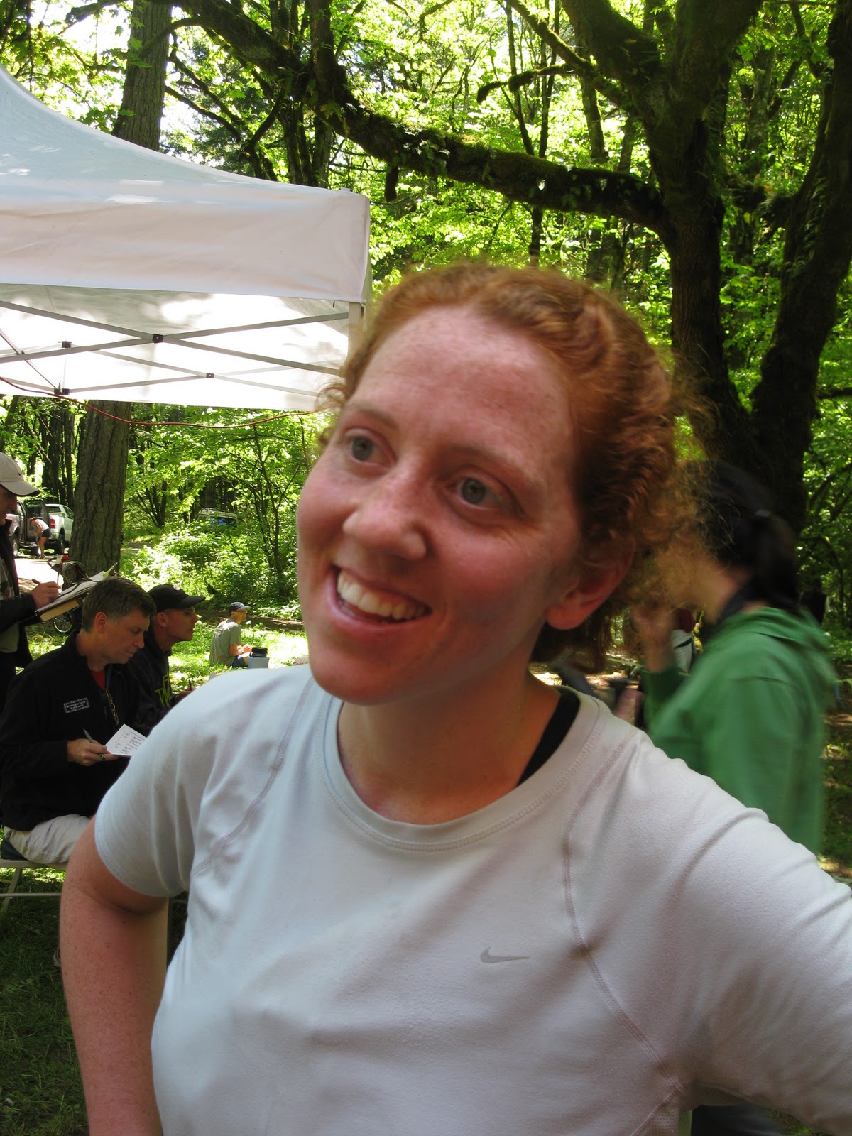
April looking happy to finish her 2nd McDonald Forest 50k

Somehow someway I randomly managed my best tempo effort of the year on the lunchtime ascent of Bald Hill from OSU Dixon Rec Center, and followed that up quickly with a 5x repeat of McCollough Peak.  Both were amazing runs, the whole return from Bald Hill I knew I was on PR pace.  I was on fire.  The McCollough ascents helped me prepare for large cumulative elevation drop at WS, it was one of the most fun runs of the year, way overdone, big mistake, and I’d do it again in a heartbeat if I had the chance, anyday. 


Oak Creek to McCollough Peak repeats.  I designed the course to look like a map of Africa.

I managed some pretty sweet running in NW and SW Oregon as I wrapped up my training for Western States.  The ascent of Mt Defiance was particularly memorable for two reasons:  this was the only run of the year in which I yogied food and water off hikers just to get back to the car (admittedly poor form for an ultrarunner), and my knee made a very intimate connection with a rock about 4000 vertical feet away from the car, the scars of which are still visible today.


Humbug Mtn and saddle in the NW Oregon coast range


Brutal and beautiful descent of the Mt Defiance trail in the Columbia River Gorge


Darlingtonia Pitcher plants in the Kalmiopsis Wilderness.

After wrapping up the intense but rewarding early season training, in June I learned just how little I know about running when I finished Western States.  No puking, no crying and only 2 naps.  I’m not sure I got what I signed up for, but that was a fun run!  Somewhere along the way I reached the existential stage of ultra-running where one no longer questions whether one can or wants to finish race, but rather questions the justification for the existence of the race altogether.  Then my brain stopped working for the next 40 miles or so.  I really enjoyed the 2nd sunrise on the trail, and 77 miles into a race is a pretty epic place to get engaged.  Thanks for pacing me in life, dear!


At the Western States finishing line.  I prefer to think of myself as 'fashionably late' rather than slow.


I experienced some minor blister issues during Western States.

I remained in denial about how poorly I recovered from Western States through the Mt Hood 50m in July, where I bested last years time by something like second by a mile and the Waldo 100km in August, which nearly ate me alive.  I felt like I really had to gut this one out and am quite happy to have crossed the finishing line.  It could have easily turned into my first DNF.  In between I managed to bike down the coast from Corvallis to San Francisco over 12 days.  It was a really fun trip.  I got a run in nearly every day on trails that I have never run before and I am definitely hoping to convince April to join me for the entire West Coast sometime.


April finishes her first 50m at Mt Hood in July.


Coastal prarie in Samuel Boardmann state park on the SW Oregon coast.


Crossing the Golden Gate by bike on the last day of a 12 day trip from Corvallis, OR to San Francisco, CA.


April and I near Mt Fuji summit at the Where's Waldo 100km in August.

In early September I moved to Switzerland to begin a postdoc in the Wind Engineering and Renewable Energy lab at EPFL in Lausanne.  Before winter set in I managed some really nice runs around Rochers de Naye twice, Leysin, and Lac Hongrin.  I was pleasantly surprised by how much of these runs were above treeline, somewhat taken aback by the (lack of) quality of construction on mountain trails here as well.  I also started a new book – An ultrarunners field guide to Swiss Cows.  Or maybe it’ll be a coffee table book.  I haven’t decided yet.


Ridgeline route near Rochers de Naye Switzerland.


Another unforested ridgeline route near Leysin, looking down at the Rhone valley and Lake Geneva.


Swiss cows make great running company in the Alps.


Seasons turning above Lake Hongrin.

By late fall snow was closing down the high mountain routes and I turned by attention back towards a spring marathon (Zurich on 4/17/2011).  I ran the Lausanne half marathon as a tuneup and returned to the track with an eye towards the 3:10 Boston qualifying time.  I don’t want to run a 3:10, I just want to be able run in some race that says I need to run a 3:10.  Plus I feel like I learned something from all the long slow distance I did in early 2010.  I want to start 2011 differently by getting faster at the shorter distances.  Finally April and I rolled up the year with a running visit to a Chocolate factory, the beautiful Swiss mountain of Moleson and a giant pot of fondue.


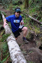
The author showcasing his amazing inability to pin a race bib number on straight while running through the UNESCO world heritage designated vineyards along Lake Geneva during the Lausanne half marathon in October.


Yasso 800's moving the right direction in late fall in preparation for Zurich marathon in April 2011.


12/19/10

Chocolate factory / fondue snow run

Since adventure running in Switzerland can be a bit of a challenge in Switzerland in December April and I penciled this this run around a tour of the Cailler/Nestle chocolate factory in Broc just in case a summit of Moleson (link to webcam, CEST = PST + 9hrs) would prove to be unattainable.  We warmed up on country roads for an hour before stopping for the hour long chocolate factory tour.   Afterwards we gorged on some amazing chocolate, recaffienated and made our way over to the town of Gruyere.  The slog up (half of) Moleson was stunningly beautiful.  As the snow deepened just enough our bellies began to growl we hit Moleson village and turned back for a giant pot of boiling cheese in the town which made it famous.  What a run!  The story in pictures ...


The run according to my new Garmin 110.  Thanks Santa!  16 (snow) miles and 3100 ft of cumulative elevation gain.  Bulle in lower right, Broc in lower left, Moleson is the prominent peak.  We got hungry and started losing daylight halfway up.


April on the way over to the chocolate factory


Summit of Moleson from near the town of Bulle.  As an aside I've misspelled Moleson.  There are 4 different types of accent marks that can be placed over the 'e' in French.


Country roads and a forest led the way over to Broc


Mecca, we have arrived!


Cocoa beans.  The whole factory smelled delish.


Is this what aid station tables will look like at races in Switzerland?  There were about 10 stations like this around the room, all free for tasting.  As the back of Aprils SOB 2010 T-shirt asks 'Is it ever possible to have too much of a good thing?'.  Don't ask an ultrarunner.


'Tourisme pedestre' sign near the town of Gruyere.  Cemetary on right, vineyard on left.


Scenic and touristy town of Gruyere.  


Starting up Moleson the way turns from road to paved path to stairs ... 


.... to dirt road.


Cattle trough on the way up towards Moleson.


Snow running/hiking is tough work, but ...


... floating on snow on the descent back towards Gruyere was epic.  Easily one of the best descents of the whole year made even better by the idea of a pot of boiling cheese awaiting at the bottom.


A giant well earned pot of fondue.  Probably not an experience I am eager to repeat but definitely worth a try.

12/4/10

Chalet a Gobet avec neige

The last two weekends Chalet a Gobet has been quite snowy.  The loop that I do often has turned from 1:08 to more like a 1:40 ...


11/12/10

Backcountry Swiss bunker touring: The endless summer continues ...


The idea for a Chateau d'Oex to Villenueve route was seeded into my head on a recent run up to the Col de Jaman when I came upon a sign with what appeared to many ideas for another good run.  Last Sunday I woke in the predawn darkness and boarded a train to Chateau d'Oex.  It seemed likely that I'd end up back on Lake Geneva by foot later in the day.  The plan called for staying a bit lower than usual, opting for dirt roads over nonexistent trails whenever possible.  The route, from Chateau d'Oex to Villenueve, would neccessitate climbing over the Col de Sonlomont and the Col de Chaude, neither of which is a gimme in November.

The route looking South from start to finish


The route from Chateau d'Oex (right) over the Col de Sonlomont, down to Lake Hongrin, over the Col de Chaude and switchbacking down to Villenueve on Lake Geneva.

Route planning is generally fairly easy in Switzerland.  Everything is (mis) labeled.  Take a train to somewhere, get off the train and look around for one of these yellow signs.  If you are lucky there will be a tiny stand open right next door selling coffee to get you going.


Topo map and estimated hiking times outside of the Chateau d'Oex train station.

The route started flat along country back roads, the Col de Sonlomont can be seen in the middle of the picture below.


Eventually the climb started past houses, pastures and then through forests.


On the climb up Col de Sonlomont


Obligatory Swiss cow photo


Still climbing up Col de Sonlomont

After I acheived the pass I had to navigate downstream of damned lake, the valley that used to hold the creek is below to the left.  The road turned into trails, then the trails turned into cow pastures.


Above Lake Hongrin outlet, the next valley I am heading for is over to the left.


Above Hongrin Resevoir outlet, storm blowing in from left to right


The route over into the next side valley looked promising up to this point, but then it promptly died out in an abandoned-for-the-year cow pasture.  This wasn't just any cow pasture though, this was a Swiss cow pasture.  I considered my situation carefully.  The map clearly showed a route down to my left, but the facts on the ground didn't line up.  There was this impossibly steep pasture.  There were some toppled and very difficult to see barbed wire fences, and an impending storm that was already shortening my desire to study the map any longer.  I did think I saw something a while back that would get me around this mess.  I just had to get down to the road by Lake Hongrin.  I backtracked for 1/2 hour before getting really frustrated at how far back the turnoff for the low route was.  When the route opened up from forest to unforested gully, I headed straight down for the lake.  It was terrible.


The gully which invited me down to Lake Hongrin


The gully shortcut alternated from young forest caked in blowdowns to impossibly steep bushwack through rosebushes and raspberries.

After 45 minutes of bushwacking my way down this slope, about 5 minutes from finally achieving the road at Lake Hongrin I came upon what I think is an old Swiss military bunker.  It turns out that Switzerland is full of these, many of which have been turned into museums.   


I didnt find any old Swiss army knives here, but the ruins were still pretty neat.  The reason I had wanted to avoid this low route was because I had to go through a tunnel, but as it turned out there was a little sidewalk in there.  The Swiss engineers obviously consider pedestrianism in their designs.  By the time I was through this tunnel it was raining in earnest.  I looked uphill to my right about half a mile to see exactly where I had turned around 1.5 hrs earlier.  The trail which was so clearly marked on my map was nothing more than a route through a cow pasture someone had imagined might be nice and decided to mark down on the paper.  There was no trace of any trail whatsoever from either side.  Still, it did have some appeal, and was the type of thing that I'm not generally averse to, as long I have a good idea what to expect.  Or, better yet, as long as I have no expectations.  When I get lost, I prefer to own it fully.


The tunnel I was hoping to avoid


Heading towards the second pass of the day

On the climb up Col de Chaude the weather turned truly nasty.  I took out my rain jacket, stuffed some food into the internal fire and picked my way up the surprisingly well built switchbacks.  This was a pretty sweet route, definitely worthy of a fair weather descent.  There were two structures on the way up.  At the first I stopped under the eaves to get a photo of what the weather was like.  My calculation that it would be snowing a few hundred meters up the valley proved correct, and I became less worried about the cold.


On the climb up Col de Jaman

There was little time for breaks however, as when I stopped for a few minutes my hands became uncomfortably cold.  I briefly considered my options, added in a factor of safety and decided the best way forward was, well, forward.


Cow created mud pits are the pits


The second and final structure heading up to Col de Jaman


The author enjoys the dregs of an endless Swiss summer.  It's not over yet!


Looking back towards the final pitch up Col de Jaman


Finally I acheived the pass, where I was promptly greeted by 40 mph wind gusts.  Despite pulling my hat down and looking down at my feet the snow still blew directly into my eyes.  I briefly considered the absurdity of running with snow goggles, then realized that this is exactly what many people do.  Meanwhile the snow was burning into the scratches on my legs from the raspberry rose bushwhack from earlier and as always, the descent down to Lake Geneva would take at least an hour.  I never warmed up ride back into Lausanne, but I did leave a rather large pool of water in the train.


On the descent to Lake Geneva with the vineyards of Villenueve yellowing on the hillside.