6/23/11

Trail de Faverges 2011 race report

Trail de Faverges 2011 race report

Ordinarily my race reports read something like a very boring choose your-own-adventure book.

1) I started conservatively since I was feeling a bit achy from last weeks efforts.

2) I started to feel better a few hours into it and then

3a) sped up and finished strong.
… or …
3b) or muddled my way through the last part.

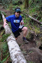
Trail de Faverges went a bit different.  The race went fine, lots of climbing and descent in a fairly short distance. I went easy and finished like I could have kept going, which is the training run I was going for.  The effort however seemed almost seemed peripheral to how comically poor the trail construction was.  Simply put, these were the worst trails I have ever run on … in my entire life.  Congestion from the mud and a huge race field was so bad I often found myself walking down hills, unable to pass groups of a dozen or more.

Never mind the weather.  It was terrible, but being from Oregon I’m used to running in the rain for months at a time.  Trails should drain water.  It’s one of the most essential parts of trail construction and maintenance.  Water bars, drainage dips, this route had none of them.  None.  There was not a single water bar on trail anywhere on the course. 

After the 2nd of what should have been 3 climbs, the course descended a set of stacked switchbacks.  Instead of shedding water at each switchback with a slight cut through, the water instead sloshed back across a banked turn to continue down the next switchback … over and over and over again, all the while gaining more and more water and washing mountains of sediment down an already rutted and deeply trenched trail.  Think of a water park with banked turns specifically designed to capture and keep water and you have an idea of the center-line gullying that defined this course. I’m not at all averse to falling while running, it happens now and then, but the outsloping on side-hill traverses on this course was so poor that runners were falling quite unnecessarily.   

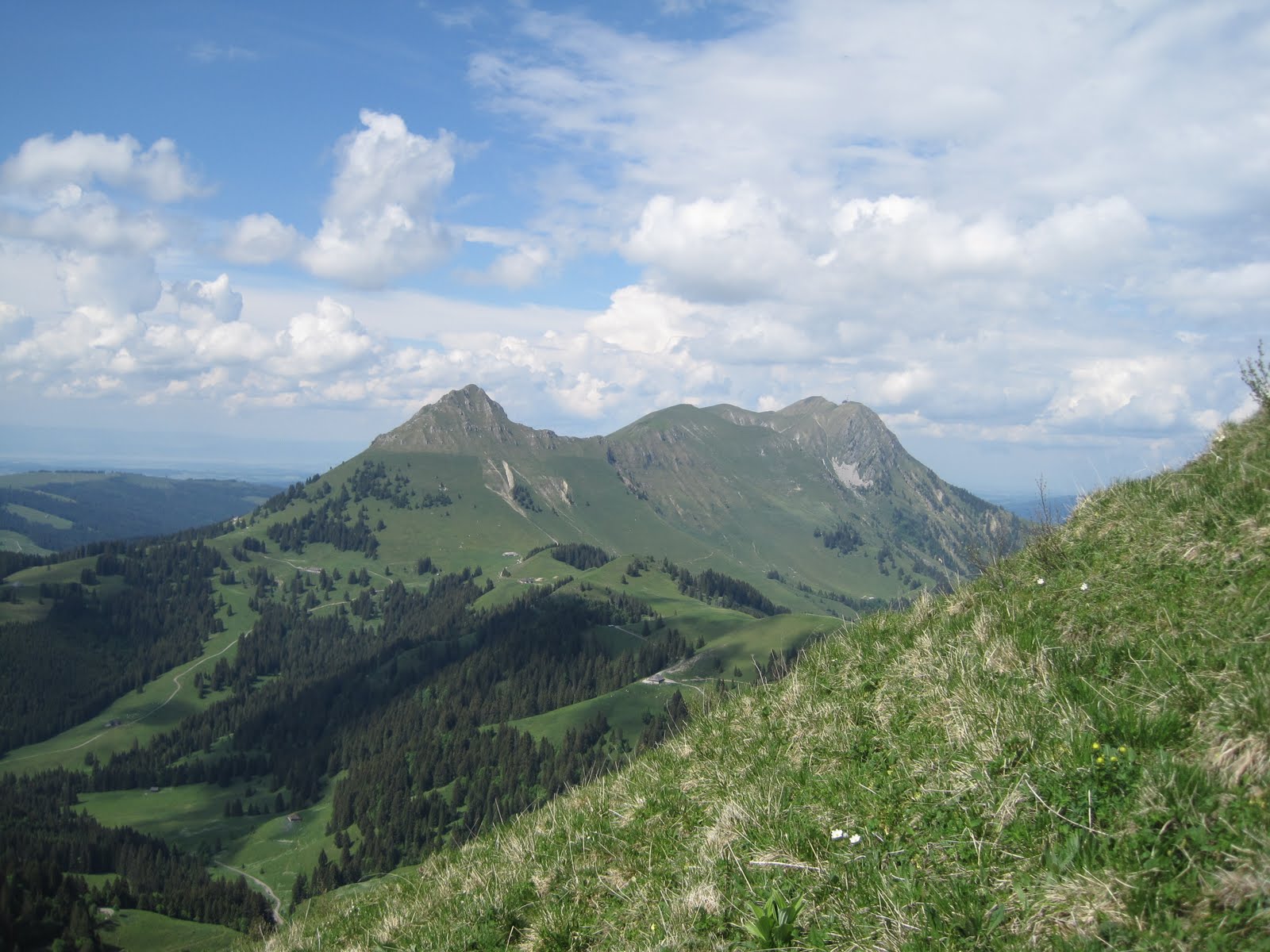
Around mid-day the course was cut short and many of us missed the 3rd climb up to the final ridge (in the photo below the course goes clock-wise, and the ridge is up to the right of the final descent, which was instead routed down the valley).  It wasn’t the rain that was the problem.  It was simply the trail construction.  The day for me was still a good training effort, but I never felt really in tune with the landscape.  I prefer to run trails, and help maintain trails, in a way that minimizes the impact on the surrounding landscape, i.e. working with the rain and meeting mountains in a manner that reflects my philosophy:  as a small and geologically insignificant sack of carbon and water cruising ridges and summits for no purpose other than a smile.  As with the Leave No Trace ethic prominent in backpacking culture, I aim to leave any mountain no worse for the wear.  The trails on this course were completely antithetical to any of these tenements, instead seemingly maximizing the sediment load into the creeks.  


Garmin says 23 miles with 7600 ft of vertical. Very happy with the effort a week after a 23 miler with 8800 ft of vertical.


Photo credit:  Trail de Faverges

6/14/11

Cornettes de Bise from Valais

As the high country in Switzerland has started to open I've begun to turn my attention to some more ambitious routes in the area:  Grand Muveran, Les Diablerets, Dents de Midi and Cornettes de Bise.  The latter has attracted my attention for a while due to it's prominence in the skyline view from Lausanne.  It's also not glaciated.  I tackled this route from Vionaz, which was actually one train stop earlier than I had hoped.  The ascent was full of nice flora, especially between 1500-2200 m in elevation.


Garmin says:  22 mi with 8560 ft of vertical.  ~ 16% grade average.  I started on the left at Vionaz, climbed up and over the ridge crest at Col de Recon, contoured around Lac d'Avroin over to Col de Verne, summited Cornettes de Bise and descended towards the Lac de Taney and finally back down to Vouvry


Pink Lilly on the climb up ...


... followed by a Chocolate Aquilegia ...


.... and what appears to be a Ghost Orchid.


Obligatory Swiss cow photo.

Signeage was pretty good, except for one spot where I missed a critical right turn and ended up a full drainage off to the left.  As a result I crested the ridge (CH/FR border) at Col de Recon instead of Col de Verne.  The Val de Verne route from Vouvry would surely have been significantly faster.  Nonetheless the jaunt over towards Cornettes de Bise on the French side of the ridge was quite nice.  It included a contour around Lac d'Arvion, which due to its beauty and accessibility was teeming with families.


Contouring over to the Lac d'Arvoin basin


Cornettes de Bise appears in the distance

A nice set of switchbacks gained the shoulder of Cornettes de Bise rather quickly, but I was unfortunately out of water.  I wondered where the the local herd of Boquetin (Ibex) drank from as I finally achieved the summit and descended via the next drainage over, which was probably only passable without an ice axe for the last 2 or 3 weeks.


Cornettes de Bise switchbacks from Col de Verne


Half-tame Bouqetin (Ibex) on the shoulders of Cornettes de Bise


The author on the summit of Cornettes de Bise


Looking back down the ascent route towards Vouvry


The descent route towards Lac de Taney.  I had this basin all to myself for a while

Like many of the higher elevation 'trails' in Switzerland, this one started out terrible.  Tread was almost nonexistent in some places, it would have been faster going up than down due to the rocks.  Finally decent tread started to appear underfoot but I was an hour past desperate for water.  Though I could trickles coming out of snow patches, they never gathered big enough to drink until below the cow pasture, where I treated the water as best as I could with my new Steri-pen.  Hope I worked it right, there were lots of flashing lights.  As an aside, I finally found a portion of a drainage in Switzerland that is not grazed.  They do exist, they are just very small.


Approaching Lac de Taney


Just above Lac de Taney, yes I drank this.

6/5/11

Going up ...

I bought trekking poles ... for running.  Seriously.  Between the questionable quality of many trails and lack of switchbacks in Switzerland this is quickly becoming the summer of hiking ... up, that is.  I've just realized that Verbier-St Bernard has over 22,000 ft of vertical in 68 miles.  That's more climbing than the 100m of the Western States course, which I did last summer.  The Tour du Mont Blanc has 31,000 ft of vertical in 103 miles.  I have no idea how to train for this sort of climbing or descent.  Perhaps the Trail de Faverges weekend after next will help.  It's got 8800 ft of vertical in 26 miles.  To put this in perspective I always thought the Mac 50km was hilly.  With 6700 ft of vertical in 31 miles it's the hilliest of all Oregon 50km's (that I know of, perhaps some of the new Rainshadow running races have more).  Waldo 100k, not a course to be taken lightly, has about half of the vertical as does Verbier St Bernard in close to the same mileage (11,000 ft in 63 miles vs 22,000 ft in 68 miles).  I struggled through Waldo 100 km terribly.

How do people train for Hardrock?  I would guess the catch is balancing a lot of quad building continuous descents on the weekends with some mid-week quality.  Too much of the first leads to none of the latter.  I'm not sure I've found a good balance.  I've heard it can take years to build up quads, and I've only been running consistently since 2008.  Last year I was quite concerned about having dead quads in the latter/flatter stages of Western States, but I was lucky to have the McDonald Forest outside of Corvallis, OR to train in.  I had a few key workouts (like McCollough Peak repeats), and steadily managed to build up a lot of vertical training (relatively speaking that is, I'm a middle of the pack, moderate mileage runner) to get sufficiently ready to finish the race.

This year is different.  I live on Lake Geneva, at the edge of the Swiss Plateau.  Weekday trail running options are terrible.  Weekend runs are through cow pasture that only someone from the continent would call 'Nature'.  Being from the Western US, it's not a good look.  The weekend runs, in which I take a train over towards the Alps do offer quite a bit of vertical though.  I've made a short table of some of my spring training runs and have been quite surprised to find out some some of them have barely been steeper than the UTMB course.  It's a bit intimidating really.  I'm OK with that.  I might not finish the course, and I'm OK with that as well.  But I definitely want to be as well trained as is possible living in a city on the Swiss Plateau, whatever that means.  Sufficient or not, it's useful to look at the numbers.

Race
date
dist (m)
vert (ft)
grade (%)
Hardrock
-
100
33992
12.9
Tour du Mont Blanc
8/27/2011
103
31160
11.5
Western States
6/27/2010
100
20000
7.6
Verbier St Bernard
8/27/2011
68
22600
12.5
Wheres Waldo
8/21/2010
62
11000
6.7
Miwok
-
62
10000
6.1
Swiss Alpin
7/30/2011
49
7800
6.0
Mt Hood PCT
7/24/2010
50
5630
4.3
The Mac
5/14/2011
32
6700
8.0
Trail de Faverges
6/18/2011
26
8800
12.7


Table 1: The context.  Mileage, cumulative vertical and average slope of races that are popular/notable, I am signed up for, or have done.  Average grade is calculated as (cumulate vertical) / (0.5*total mileage). 


Course
date
dist (m)
vert (ft)
grade (%)
Mont d'Or, Dent de Vaulion
1/9/2011
17.0
5398
12.0
Sulpher Springs Loop
1/22/2011
14.5
3825
10.0
Montricher to Mt Tendre
2/13/2011
21.0
3900
7.0
Versancy to Jura Crest
3/13/2011
17.5
4033
8.7
Biere to Vallorbe
3/26/2011
25.3
5400
8.1
Moleson I
4/9/2011
19.0
5600
11.2
Vallorbe to Champagne
4/22/2011
26.8
6300
8.9
Moleson 2
4/25/2011
14.1
4710
12.7
Mt Aubert
5/1/2011
22.5
4418
7.4
The Mac
5/14/2011
31.6
6700
8.0
Col de Lys
5/22/2011
13.7
4400
12.2


Table 2: The training.  Mileage, cumulative vertical and average slope of some of this years training runs.


Point of all of this is probably two-fold:


1) Races in the Alps are crazy steep.  Look at how, for the same amount of vertical, Verbier St-Bernard's 68 miles compares with Western States 100 m, or how Trail de Faverges 26 mi compares with Oregon hilliest ultra (31 m), the Mac 50km.

2) My concerns about my weekday hill runs not quite cutting the mustard are probably well founded.  The hilliest route I have found so far is along Le Flon through the Bois de Sauvebelin, and nets 1100 vertical feet in 7.1 miles total, at an average grade of 6 %.  That's just not enough.

6/3/11

Col de Lys, Col de Soladier, Les Avants


The Col de Lys is quite nice.  I started from Les Casses but quickly ran out of trail.  Not recommended.  Next time I would try the Eastern ascent from Montbovon or Albeuve.  Much of the 'trail' is actually just cow pasture, very uneven and of poor quality, but the views of the Swiss mountain pastures are fantastic.  I made my way over Col de Lys and then over Col de Soladier.  Rather than coming home from Col de Jaman, I opted to take the train back from Les Avants.  Its mostly dirt double track from Col de Soladier to Les Avants.  This route was quite fun and consisted of 4400 vertical feet in 14 miles, which is quite a bit.  If this degree of climbing and descent kept up for 100 miles it would net 35,000 ft of vertical, which is about 15% more that the UTMB (30,000 ft of vertical) that I am training for.


Swiss trail crew - not budging


On the climb up Col de Lys.  Dandelions in fruit filled the air.


Orchid near the ridgeline


Looking down at the Eastern ascent of Col de Lys


Looking south from Col de Lys at Vanil de Artes and Rochers de Naye


From Col de Soladier looking back at Moleson and Teysachaux