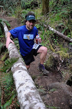
Though I still haven't managed to fully shake off the ankle/calf injury that I sustained a few weeks ago the weather was so nice I went out anyways to explore some of the Jura Crest Trail (Chemin de Cretes de Jura). It seems that after a cold and snowy December winter is likely to end early and with more of a whimper than a bang here in Switzerland, thus I had high hopes for good trail conditions on Saturday. Ostensibly the primary goal was to find a convenient high quality climb for hill repeat training for UTMB, but really I just wanted some good quality time to get to know the Jura mountains.

Sunrise over the Swiss Plateau from near the town of Montricher (see map at bottom)

These signs are all over the mountains in Switzerland
The climb out of Montricher to the summit of Mt Tendre, 3238 of vertical in 5.2 miles at 12% grade, was all that I had hoped for. High quality trail, generally well constructed and maintained, and definitely a worthy place for repeats. It wasn't until about 4500 ft or so until icy conditions began. The snow wasn't bad, especially not in the pastures near the summit of Mt Tendre (5457 ft), but some of the forested gullies were completely iced over. My hope that this was only a function of time of day proved unwarranted, and some tricky sections had to be navigated quite slowly over the course of the day.

Half a mile south of Mt Tendre on the Jura Crest Trail (Chemin de Crete du Jura) the trail traversed an icy sidehill with a long and dangerous runout. I opted for the bare ridgeline where there was no danger of a slide.

Looking back at Mt Tendre on the crest of the Jura mountains. A few minutes earlier I was on the summit in a whiteout

Summertime Chalet on the crest. Rock mover lever thing-a-ma-bob and solar panels.


Old WWII fortications on the Jura Crest near the French Swiss border
The trail along much of the crest is of good quality, especially the forested sections. As per usual in Switzerland, the trail was often routed through summertime cow pastures. While the views are splendid, the footing can be quite tricky. Routes like this make make me happy I played a ton of tennis growing up, the constant side to side motion of the game led to great ankle strength.

Summit shot from the Mont de Biere

Fantastic descents heading north towards the Col de Marchairuz and Crete de la Nueve
While the snow in the pastures was fairly straightforward and not too significant, there was some really icy conditions in the forest. I had to climb my way around much of the trail, clinging to whatever shrubbery I could along the side of the trail.

Icy gully

Towards the summit of Crete de la Nueve

Approaching St Cergue on the Chemin de Crete de Jura

Garmin says 5600/3350 ft of vertical in 21 miles.
All in all not bad for a early season outing in icy conditions. Though I got a little bit rough around the edges earlier in the run than I would like to, it's only to be expected with the snow making for slow going. It was great to be able to take advantage of the sunshine. The route, starting in Montricher climbing up to Mt Tendre and South along the Jura Crest Trail with Mont Biere, Col de Marchairuz, Crete de la Nueve and down to St Cergue was quite fun and will make a good addition to the SFP (Swiss Footprint Project). If someone were wishing for a shorter route I highly would recommend heading North from Cold de Marachuz to Mont Biere (Derriere) and the Ski Chalet. This section, and the section continuing on to Mt Tendre, was quite scenic.