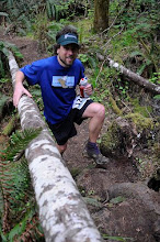
After a 5 hour delay we headed down to Chamonix. There were thousands of runners there and even more thousands of people. The announcer was working the crowd up, and finally we were off. The rain continued throughout most of the night but daylight arose fairly quickly. Maybe 11.30 pm race starts aren't such a bad thing.
The 2nd climb of the day up Croix de Bonhomme was quite nice. It had snowed the night before and the trail was crowded and in poor condition. The video here from about 5:00 to 5:40 gives a very small look at the way trails are around the Mont Blanc area: braided 5 wide all on the fall line and centerline gullyed to knee deep. Even still passing was a chore. On the downhills some people had their poles pointed up and backwards, ie at eye level, and others seemed to hold the out very wide. The very crowded races in Europe (like this one) create a particular vibe between runners. It's the same feeling as sitting in a monday morning traffic jam. The groups of foreigners were talkative, groups of Spaniards, Japanese, Italians, American and English, but the French men, who comprise 70+ % of the race field (2300 runners in the UTMB, 80% overall French runners, 90% male!) were so quiet. Le Chapieux aid station tent was so crowded it I was surprised it wasn't shut down by the fire department. Runners were stacked 3 deep trying to get to the Aid station tables.
We finally left Le Chapieux after controle checked us for phones. Initially it seemed so strange to carry phones during a mountain event but the mountains in Europe as just so different from the States. Here, they are totally developed, restaurants, hotels, alpage fromageries, sheep, cows, cell phone towers, and villages. The Col de la Seigne was an incredibly beautiful and foggy pass but the other side was completely sunny. As the media helicopters were taking full advantage to film the runners up and down the valley everyones cell phones simultaneoulsy rang out with details of a 2nd course change. It was very nice that the race organization let us know of this quite efficiently.
On the climb up and over the shoulder of Arete du Mont Favre it started to warm up and bit and the brutal descent into Courmayer left us right at the cutoff. Regardless April wanted to continue and we climbed up onto the ridge of the Val Ferret. As the sun began to go down on a 2nd night up I got so sleepy. At the 1st refuge I laid down to sleep for a bit, then got up and my temporarily low energy level meant I could only really walk to the 2nd refuge. At the 2nd refuge we were told that we had only 25 minutes to do the 3 miles into the control at Arnuva and mentally I checked out.
Upon getting home it became apparent that the race organizers had extended the cutoff at Arnuva and at many other aid stations along the way. Why we weren't told of this while leaving Refuge Bonati is beyond me. We were THE target audience for this information. Another half hour would have meant the difference between a slow walk to a cutoff we'd missed and a brisk jog to make the cutoff and get up on the Col de Ferret. Perhaps its a moot point. We still had 40+ miles to go after Arnuva, but I paid my money to run as much of the course as I could and I should have the proper information to do so, or at least as much as others on the course. We did not. If race organization can schedule helicopters all over the course and update my facebook status for me in real time why couldn't they notify the previous aid station that the next time cutoff had been extended?
8/31/11
8/15/11
Saturday in the Val Ferret
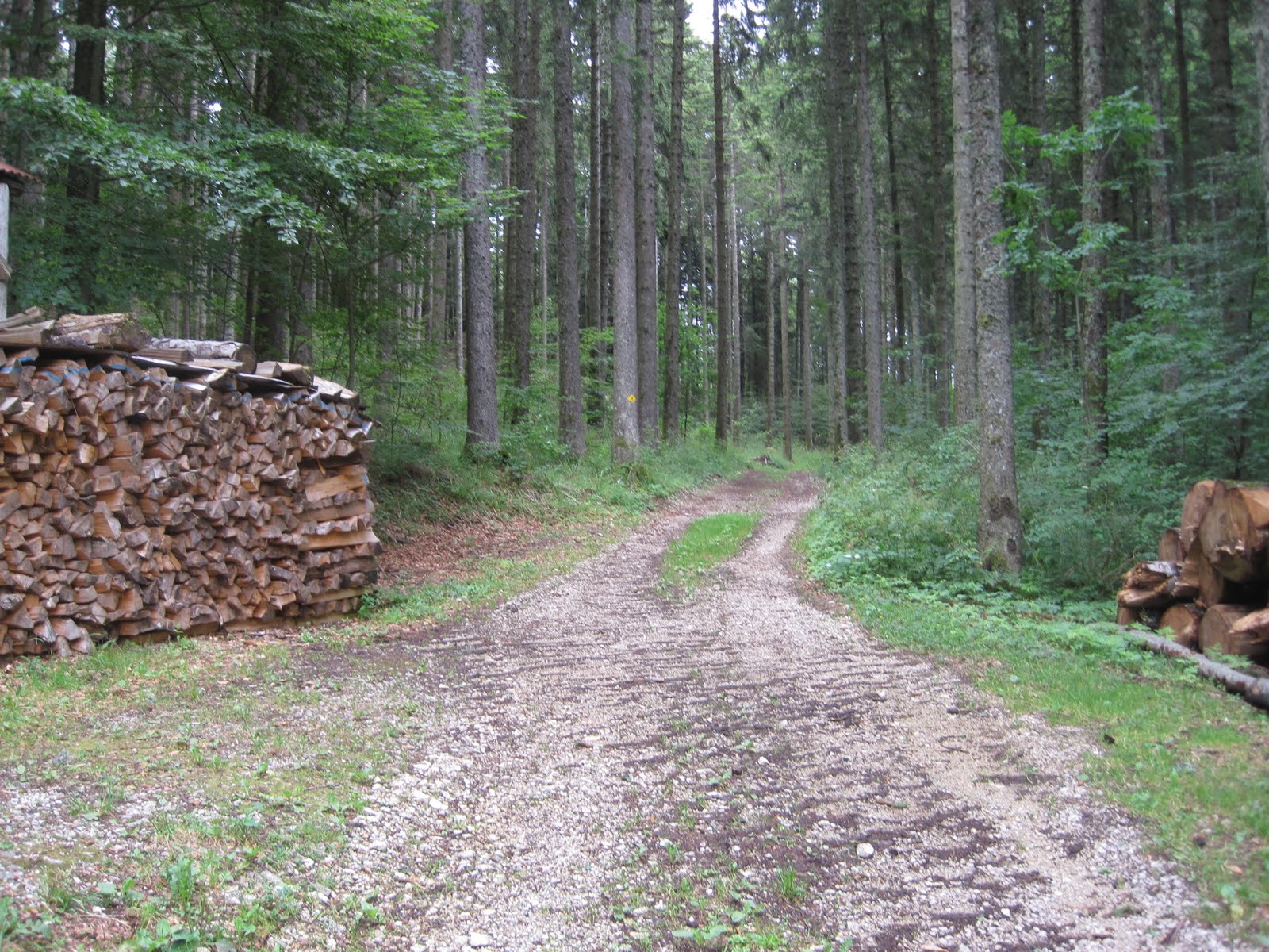
6 weeks ago on the Trail Verbier St Bernard course I had a very tough time on the climb up to Lac de Fenetre from La Fouly. Although I had 30 less miles on my legs, Friday's climb back up to the same went much better. The Val Ferret in Switzerland is incredibly scenic. Huge big landscapes, glaciated peaks and deeply glaciated valleys. And, of course, egregious amounts vertical. I managed 4100 ft of vertical in 6.5 miles (round trip) on Saturday morning's ascent of La Dotse, much of it at 30-40% grade, which is slightly less than the gradient where one would prefer to put a hand on the slope for help in ascending.

My first run was the incredibly popular ascent to Lac de Fenetre

Headwaters of Le Dranse de Ferret. The high peaks in the background are the CH/IT border

The first Lac de Fenetre and the Col de Fenetre in the background. The Trail de Verbier St Bernard took us over the Col de Fenetre and around the Italian side back to Grand St Bernard Pass
Rather than retracing my steps up to Col de Fenetre I opted for the green dashed line option over to Col de Bastillon. In retrospect the climb up to Col de Fenetre is much nicer.

Swiss trail leading up to Col de Bastillon from Lac de Fenetre. Half tread, check. Overly outsloped, check. 40+% grade, check. At least 20m of exposure, check.

Descent from Lac de Fenetre down the upper Val Ferret

Early sunset over Mt Telliers

Saturday's jaunt. Down valley, cross the river and climb up La Dotse

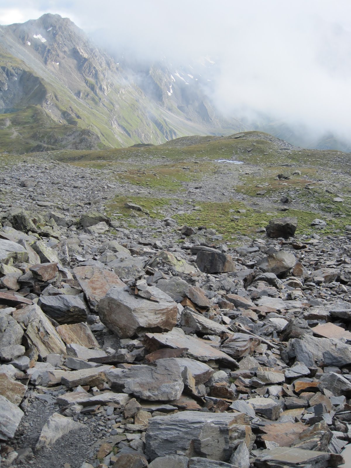
The climb around La Dotse on the Tour du Mont Blanc course. Picture is taken looking back towards the Col de Ferret. Both Italy and Switzerland call the basins emanating from their respective side of this drainage Val Ferret. Les Marmontains on the left, CH/IT border in the background

Mt Dolent is the meeting point of the FR/CH/IT borders

Navigating a gauntlet of electrified fences to achieve the summit of La Dotse. In retrospect the better route would have been the most direct line from La Peule (the Alpage/resto) just below. I traversed/climbed around the backside looking for a route on the back ridgeline and encountered way too many of these.

Edelweiss

Garmin says: 2820 ft of vertical in 5.45 miles (in blue) and 4130 ft of vertical 6.45 miles (in red). Click to enlarge.
8/11/11
Pas de Lovenex - St Gingolph to Les Evouttes
Somehow, someway, every time I set out to summit Le Grammont from Valais I never quite end up on the top. I still managed a quite nice day out in the Swiss moutains, taking in the Pas de Lovenex starting from St Gingolph and ending up back down on the floor of Valais in Les Evouttes. The amount of sustained vertical possible in the Swiss Canton of Valais is astounding.

The climb up from the CH/FR border town of St Gingolph had some nice bits of singletrack mixed with some perilous road walking

Chalet above St Gingolph. Guess which side of the border this is one. Hint: note impeccable wood stacking.

This stream is the actual CH/FR border above St Gingolph

On the climb up to Pas de Lovenex through cow pasture

Looking back down towards the CH/FR border

Near Lac de Lovenex

Col de la Croix from Pas de Lovenex, Lovenex basin down to the right

Alpage above Lac du Taney


Lac du Taney

Now those are cowbells!

The descent from Lac du Taney towards Les Evouttes featured some of the nicest singletrack I have run on in Switzerland

On the descent from Lac du Taney towards Les Evouttes

Garmin says: 5720 ft of vertical in 14.3 miles (click to enlarge). The orange track is from a previous effort up Cornettes de Bise.
8/5/11
Swiss Alpin Davos 2011 race report
After last month's DNF at Verbier-St Bernard I was determined to have a smart race at the Swiss Alpin Davos 78 km. I must confess I am quite superstitious when it comes to running outfits and I can't shake the feeling that I just wore too many clashing colors on my way over Col de Fenetre and Grand St Bernard. I guess the plan mostly was to ditch the green buff that I got at my 5th Macdonald Forest 50k this year, but it doesn't quite sit right with me. This buff is so versatile and useful in keeping cool on hot days, but it just doesn't match any other running shirts I have. :( Anyhoo, I dressed and ran conservatively from the starting line at Davos. The first half of the 78km (~50m) is a mix of paved and dirt roads. If one wanted to put some trail shoes at the 40 km drop bag in Burgun it wouldn't be a bad idea to start in road shoes at all. Water stations were plentiful but it helped that I brought a bunch of gels and chews as the Aid stations consisted of granola bars, bananas and ice tea. The cowbells rang loud and put anything I've ever seen before to shame. The alphorns on course were also really a nice touch. After 31 km of running down-valley through gorgeous Swiss countryside the short course split off and we finally got a break from the traffic. Wow this race was crowded, even the double track did little to alleviate the congestion of multiple thousands of starters from the combined 78k and 31k starts.
I thought the congestion was over for good but it turns out there was another marathon starting in Burgun at the same time as the mid-packers in the 78 km were passing through. We collectively climbed up and over the first pass of the day in a train of hundreds upon thousands with little more than a meter in front or behind each runner. All the while a helicopter circled overhead reminding me of evening news broadcasts on freeway traffic jams. I'll never understand how some European races feel the need to rent helicopters to advertise huge race fields like it was a nice thing.
http://www.youtube.com/watch?v=oUsZflqe66w&feature=related
By and by I achieved Kuschutte just after it started raining. Despite the clear blue skies at the time, not picking up my gloves and jacket at Bergun was a mistake and my achy hands would let me know it for the next hour. The race organizers had clearly planned for my ignorance and i grabbed a light trashbag/rainsuit from one of the boxes at the top. Unfortunately the trail was so congested it was hard to adjust my pace to keep warm but the climb up Sertigpass helped. Afterwards I managed to pass about 40 people in 2 minutes to finally get some freedom to run down the other side. Wow, beautiful scenery, nice singletrack, no cows. What a wonderful couple of miles.
Unfortunately the descent really excacerbated the shin splints I've been suffering from lately and I ended up having to walk much of the last 15 miles in (photos of me not running here). Anyways that's sort of just how the year has been. Dealing with injuries and not doing it very well. It's clear that I'll have to rethink and regroup from my current situation with at least a few weeks off sooner or later, but in the meantime it's nice to finally notch a 50 miler this year. It's about time. The scenery in this race is fantastic and very Swiss.

Garmin says 49.8 miles with 10300 ft of vertical
8/2/11
Jogging in the Jura: La Dole
Though I've had the pleasure of climbing to the crest of the Jura mountains from the Swiss Plateau a few times now, only last week did I finally manage to tag the summit of La Dole. Residents of Geneva, Lausanne, Nyon and Yverdon can instantly pick out La Dole on a clear day by 1) the radar on the summit, and 2) the massive rock face just below the summit. I started from La Rippe on the FR/CH border and ended my trip in St Cergue so that I would achieve some mille feuille from the amazing bakery there. If you've never partaken of this particular pastry before, rest assured it's definitely worth at least 4500 ft of vertical in 11 miles.

La Barillete tower just below La Dole from the Swiss Plateau. La Rippe was about as close as I could get to the climb via bus.
Although clearly marked on the Swiss topo map website, the route up to the crest was a confusing jumble of roads and singletrack that never seemed to fully commit to anything. If I did this route again I would totally ignore the map and just navigate by feel. Up is the way to go.

Chalet la Dole just below the Crest. Almost the entire crest of the Swiss Jura's is cow pasture. Great views, not so great smells. The best time for running it is sometime after the Crocus have started coming up and before the cows return to the mountains for the summer.

From Chalet la Dole the route up to the crest
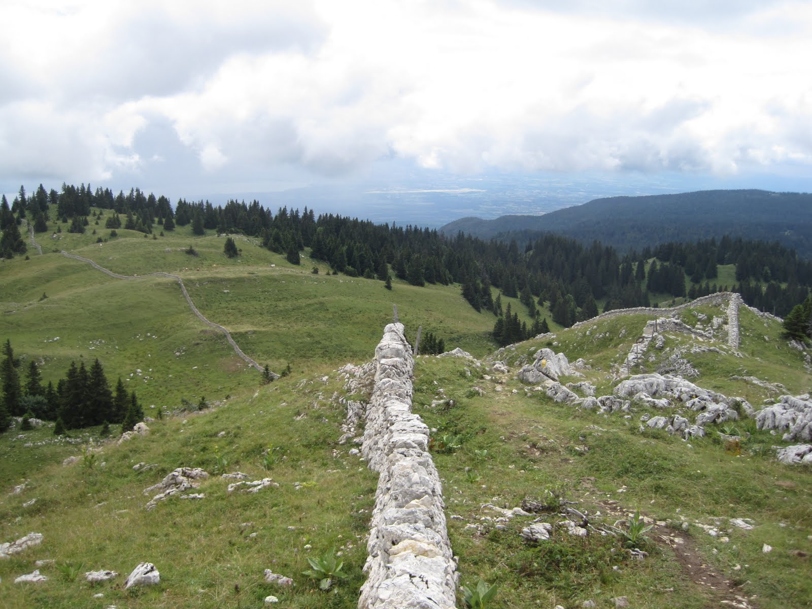
Amazing rock work on the Crest of the Juras

The signature radar station on the summit of La Dole

"Trail" on the Jura Crest heading north from La Dole down towards St Cergue

La Dole's signature rock face

Obligatory Swiss Cow photo.

The days effort (in purple). Click to enlarge. 4500 ft of positive vertical in 11 miles. The route started in La Rippe.
8/1/11
Aviemore / Cairgorms - Or how i learned to pronounce my first name
A few months ago I had a chance to visit Scotland for a conference on Alpine Meteorology. I've always wanted to visit Scotland, so perhaps it's a case of love before first sight, but WOW! What an amazing landscape. Aside from the American West I've never felt a landscape move me in this manner. There are very few trees, at least on the hills, and the endless views and climbs rolled out of before me for miles on end. I was in Aviemore, outside of the Cairngorm National Park for the better part of a week, and managed a run up the Craigelachie's, up Geal-Charn-Mor, and finally up Cairngorm itself (webcam). Due to weather related issues I did not manage Ben Macdui (Scotland's 2nd highest peak). I didn't mind. The weather was terrible/average. That is, the blowing snow at 40+ mph did not seem out of the ordinary at all to the rangers at the station. The people were so friendly, and the country felt comfortably rough around the edge.
I stopped by the ranger station on the way up the summit to Cairngorm and asked the rangers about some natural features on the topo map.
'Ummm, this one, what exactly is that?'.
'Oh cuuhhhreeeaaag, thats a bunch of rocks.'
'Oh really, because my name is Craig'.
'What? Youre name is what?'.
'Craig'. 'No it's Cuhhhreeeaagggg'.
Point of the story is that, at the ripe age of 33, I finally learned the proper pronunciation of my first name .... In Gaelic it's spelled differently, with an exotic and exciting combinaton of vowels! Long story short, I've almost never seen a landscape that moved me as much. The landscape seems so infused with the culture. It's amazing and I cant wait to return ... hopefully on a sunny day.

Cairngorm from the Windy Ridge trail

Really nice rockwork

A beatiful ribbon of trail descending Cairngorm towards Glenmore

Descending towards Glenmore from Cairngorm


Looking back at Cairngorm from Aviemore. The only blue sky I saw for a week.
Subscribe to:
Posts (Atom)