While mountain running in Switzerland in January might not seem like the brightest idea, the bad case of cabin fever I've been nursing for the last few weeks led me out to the Jura's to take advantage of a rare snow-free weekend. There has been snow on the ground pretty consistently for the last few weeks in Lausanne. Last week I ran by the track on a Monday figuring it would clear soon. Friday I was there kicking the snow out of lane 1. Nailed my 400's though so it was worth it. The unfortunate consequence of living car-free in a city is that my weekday runs are woefully lacking in vertical.
Vallorbe seemed like a good choice because its only a 45 min train ride from Lausanne, has a few nearby peaks, and would allow for a point to point up to Sainte-Croixe if conditions were good. The crest of the Jura's, often unforested, is also low enough (1400-1500m) to be snow free at times that higher up in the Alps isn't. I awoke early and was surprised by how clear the sky was on my predawn walk down to the train station. After disembarking at Vallorbe I switched on the flashlight and decided to summit Mont d'Or first. Since it was dark I didn't enough of a feel of the conditions weatherwise to justify the point to point attempt, which would require at least a few consecutive hours exposed above treeline, most likely without a good bail out option.

On the initial ascent of Mont d'Or
Looking down on the border town of Vallorbe from the slopes of Mont d'Or. Vallorbe sits in a narrow cleft through the Jura mountains, and is an important transit stop between Switzerland and France (see Garmin map below)
After a few wrong turns and an hour or so of climbing the trees began to thin and the clouds began to thicken. It seems that no matter how high one goes in Switzerland there is always some summer cow pasture even higher. The cows, however, had gone down the slopes for the winter and I would not today be able to add to my Field guide to Swiss cows picture book, but I did manage to sight a
Chamois (pronounced Cham-Wow!) for the first time. It's not everyday that one gets to see new mega-fauna. These things are definitely common around here. I ran on their trails and through their tracks all morning. I'm pretty sure the one below is a solitary male, while higher up the slope I saw a female and few kiddos.
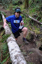
About 2/3 of the way Mont d'Or
The Chamois was not afraid of humans at all
Zoomed in picture of the Chamois (sorry for the poor quality)
The wind began to howl and the rain came down in earnest as I eventually I gained the summit ridgeline: totally unforested just like Google Earth told me it would be. Amazing! There was no real trail through parts of this, but there was never a question of which way to head. Up, of course!
Approaching the summit ridgeline of Mont d'Or
The coolest part about this route was that I was right along the French Swiss border (see map below, yellow line). Though I had never even been to France, I probably wasn't going to get my passport stamped today.
The French Swiss border on Mont d'Or.
I intended to look both ways before actually crossing the border, but the wind was howling and the rain totally dumping now. As I traversed the ridgeline out my left cheek chilled so much that it hurt. On the way back my right cheek instead froze.
Unforested ridgeline route on Mont d'Or
This is about where I turned back, the ridge began to drop just over the next hill, on top of which a chairlift is barely visible.
On the way down I flew over the hummocks in the cow pastures. There wasn't really a trail here but I have strong ankles from playing lots of tennis as a kid. I was loving the creative proprioception that the empty pasture required so much that I missed a turn off and ended up back at the border, which I was able to use for navigation. Despite the low visibility that subsequently engulfed the crest of the Jura's I eventually made my way down the valley, crossing the Vallorbe river in the city itself and back up the other side to tackle the Dent of Vaulion. It was way too early to call it a day, but any hope of traversing over to Sainte-Croixe to gain my first section run of the Jura Crest was gone. The cloudless sky leaving my apartment hours ago and led me to incorrectly choose my windproof (not waterproof) windshirt instead of my waterproof Anorak, all for a measly 2 oz weight savings. Anyways I was going to make the most of the day.
The French Swiss border pt I
The French Swiss border pt II
On the first descent of the day I stopped under a structure to capture the weather
Ascending Dent de Vaulion. Deer would not take this trail.
The ascent of Dent de Vaulion was not signed quite as much as I had hoped and I opted for a trail which was not particularly well built. Regarding some of the moutain trails around here that is almost a redundant statement. From the looks of it the Dent was sheer rock face from the East, but this "trail" seemed to be intent on ascending from that face. Whenever I had the chance I veered to my left for information gathering and finally spied a decent dirt road. I bushwacked my way down to pick it up, planning to circumnavigate half the Dent and see if the Southern ascent trail was in better condition. A quarter way around I happened upon some power lines heading straight up. Hmmm, these looked promising, the entire route beneath them seemed well brushed too so I opted to turn in the direction of up and slowly counted each pole as I passed. 10, 11, 12, wow the grade was like 1000+ ft/mile. After a few more I finally sighted the summit marker (see the straight line at the top of the climb on the map below). Besides the driving rain coming down in sheets and wind ripping through my bones the summit was really awesome.

I followed these lines to the summit
Summit of Dent de Vaulion in view
At the summit of Dent de Vaulion, the picture does not do justice to the weather
Descending dirt track back towards Vallorbe
Happy to reach the second summit of day I raced the rain back down the valley. Initially the snow had great texture, allowing for fast effortless running, though it gradually gave way to shoe-sucking murk, maintained dirt roads and finally the pavement that would bring me back to a cold train station. During the 45 minutes I had to wait for the train I squeezed all the water I could out of clothes into the bathroom sink and thought about nothing but food. It felt great to get in a good solid effort in the dead of winter and I won't complain about the weather, that's just January in the Jura's! Only two more weeks until the UTMB lottery, fingers are crossed!
The route according to Garmin: 5400 ft of elevation over 17 miles. The yellow line is the French Swiss border, the town of Vallorbe is in the center