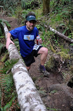
I bought trekking poles ... for running. Seriously. Between the questionable quality of many trails and lack of switchbacks in Switzerland this is quickly becoming the summer of hiking ... up, that is. I've just realized that Verbier-St Bernard has over 22,000 ft of vertical in 68 miles. That's more climbing than the 100m of the Western States course, which I did last summer. The Tour du Mont Blanc has 31,000 ft of vertical in 103 miles. I have no idea how to train for this sort of climbing or descent. Perhaps the Trail de Faverges weekend after next will help. It's got 8800 ft of vertical in 26 miles. To put this in perspective I always thought the Mac 50km was hilly. With 6700 ft of vertical in 31 miles it's the hilliest of all Oregon 50km's (that I know of, perhaps some of the new Rainshadow running races have more). Waldo 100k, not a course to be taken lightly, has about half of the vertical as does Verbier St Bernard in close to the same mileage (11,000 ft in 63 miles vs 22,000 ft in 68 miles). I struggled through Waldo 100 km terribly.
How do people train for Hardrock? I would guess the catch is balancing a lot of quad building continuous descents on the weekends with some mid-week quality. Too much of the first leads to none of the latter. I'm not sure I've found a good balance. I've heard it can take years to build up quads, and I've only been running consistently since 2008. Last year I was quite concerned about having dead quads in the latter/flatter stages of Western States, but I was lucky to have the McDonald Forest outside of Corvallis, OR to train in. I had a few key workouts (like McCollough Peak repeats), and steadily managed to build up a lot of vertical training (relatively speaking that is, I'm a middle of the pack, moderate mileage runner) to get sufficiently ready to finish the race.
This year is different. I live on Lake Geneva, at the edge of the Swiss Plateau. Weekday trail running options are terrible. Weekend runs are through cow pasture that only someone from the continent would call 'Nature'. Being from the Western US, it's not a good look. The weekend runs, in which I take a train over towards the Alps do offer quite a bit of vertical though. I've made a short table of some of my spring training runs and have been quite surprised to find out some some of them have barely been steeper than the UTMB course. It's a bit intimidating really. I'm OK with that. I might not finish the course, and I'm OK with that as well. But I definitely want to be as well trained as is possible living in a city on the Swiss Plateau, whatever that means. Sufficient or not, it's useful to look at the numbers.
Race | date | dist (m) | vert (ft) | grade (%) |
Hardrock | - | 100 | 33992 | 12.9 |
Tour du | 103 | 31160 | 11.5 | |
Western States | 100 | 20000 | 7.6 | |
Verbier St Bernard | 68 | 22600 | 12.5 | |
Wheres Waldo | 62 | 11000 | 6.7 | |
Miwok | - | 62 | 10000 | 6.1 |
Swiss Alpin | 49 | 7800 | 6.0 | |
Mt Hood PCT | 50 | 5630 | 4.3 | |
The Mac | 32 | 6700 | 8.0 | |
Trail de Faverges | 26 | 8800 | 12.7 |
Table 1: The context. Mileage, cumulative vertical and average slope of races that are popular/notable, I am signed up for, or have done. Average grade is calculated as (cumulate vertical) / (0.5*total mileage).
Course | date | dist (m) | vert (ft) | grade (%) |
Mont d'Or, Dent de Vaulion | 17.0 | 5398 | 12.0 | |
Sulpher Springs Loop | 14.5 | 3825 | 10.0 | |
Montricher to Mt Tendre | 21.0 | 3900 | 7.0 | |
Versancy to Jura Crest | 17.5 | 4033 | 8.7 | |
Biere to Vallorbe | 25.3 | 5400 | 8.1 | |
Moleson I | 19.0 | 5600 | 11.2 | |
Vallorbe to | 26.8 | 6300 | 8.9 | |
Moleson 2 | 14.1 | 4710 | 12.7 | |
Mt Aubert | 22.5 | 4418 | 7.4 | |
The Mac | 31.6 | 6700 | 8.0 | |
Col de Lys | 13.7 | 4400 | 12.2 |
Table 2: The training. Mileage, cumulative vertical and average slope of some of this years training runs.
.
Point of all of this is probably two-fold:
1) Races in the Alps are crazy steep. Look at how, for the same amount of vertical, Verbier St-Bernard's 68 miles compares with Western States 100 m, or how Trail de Faverges 26 mi compares with Oregon hilliest ultra (31 m), the Mac 50km.
2) My concerns about my weekday hill runs not quite cutting the mustard are probably well founded. The hilliest route I have found so far is along Le Flon through the Bois de Sauvebelin, and nets 1100 vertical feet in 7.1 miles total, at an average grade of 6 %. That's just not enough.


No comments:
Post a Comment