8/5/11

Swiss Alpin Davos 2011 race report

After last month's DNF at Verbier-St Bernard I was determined to have a smart race at the Swiss Alpin Davos 78 km.  I must confess I am quite superstitious when it comes to running outfits and I can't shake the feeling that I just wore too many clashing colors on my way over Col de Fenetre and Grand St Bernard.  I guess the plan mostly was to ditch the green buff that I got at my 5th Macdonald Forest 50k this year, but it doesn't quite sit right with me.  This buff is so versatile and useful in keeping cool on hot days, but it just doesn't match any other running shirts I have. :(  Anyhoo, I dressed and ran conservatively from the starting line at Davos.  The first half of the 78km (~50m) is a mix of paved and dirt roads.  If one wanted to  put some trail shoes at the 40 km drop bag in Burgun it wouldn't be a bad idea to start in road shoes at all.  Water stations were plentiful but it helped that I brought a bunch of gels and chews as the Aid stations consisted of granola bars, bananas and ice tea.  The cowbells rang loud and put anything I've ever seen before to shame.  The alphorns on course were also really a nice touch.  After 31 km of running down-valley through gorgeous Swiss countryside the short course split off and we finally got a break from the traffic.  Wow this race was crowded, even the double track did little to alleviate the congestion of multiple thousands of starters from the combined 78k and 31k starts.

I thought the congestion was over for good but it turns out there was another marathon starting in Burgun at the same time as the mid-packers in the 78 km were passing through.  We collectively climbed up and over the first pass of the day in a train of hundreds upon thousands with little more than a meter in front or behind each runner.  All the while a helicopter circled overhead reminding me of evening news broadcasts on freeway traffic jams.  I'll never understand how some European races feel the need to rent helicopters to advertise  huge race fields like it was a nice thing.

http://www.youtube.com/watch?v=oUsZflqe66w&feature=related

By and by I achieved Kuschutte just after it started raining.  Despite the clear blue skies at the time, not picking up my gloves and jacket at Bergun was a mistake and my achy hands would let me know it for the next hour.  The race organizers had clearly planned for my ignorance and i grabbed a light trashbag/rainsuit from one of the boxes at the top.  Unfortunately the trail was so congested it was hard to adjust my pace to keep warm but the climb up Sertigpass helped.  Afterwards I managed to pass about 40 people in 2 minutes to finally get some freedom to run down the other side.  Wow, beautiful scenery, nice singletrack, no cows.  What a wonderful couple of miles.

Unfortunately the descent really excacerbated the shin splints I've been suffering from lately and I ended up having to walk much of the last 15 miles in (photos of me not running here).   Anyways that's sort of just how the year has been.   Dealing with injuries and not doing it very well.  It's clear that I'll have to rethink and regroup from my current situation with at least a few weeks off sooner or later, but in the meantime it's nice to finally notch a 50 miler this year.  It's about time.  The scenery in this race is fantastic and very Swiss.


Garmin says 49.8 miles with 10300 ft of vertical

8/2/11

Jogging in the Jura: La Dole


Though I've had the pleasure of climbing to the crest of the Jura mountains from the Swiss Plateau a few times now, only last week did I finally manage to tag the summit of La Dole.  Residents of Geneva, Lausanne, Nyon and Yverdon can instantly pick out La Dole on a clear day by 1) the radar on the summit, and 2) the massive rock face just below the summit.  I started from La Rippe on the FR/CH border and ended my trip in St Cergue so that I would achieve some mille feuille from the amazing bakery there.  If you've never partaken of this particular pastry before, rest assured it's definitely worth at least 4500 ft of vertical in 11 miles.  


La Barillete tower just below La Dole from the Swiss Plateau.  La Rippe was about as close as I could get to the climb via bus.


Although clearly marked on the Swiss topo map website, the route up to the crest was a confusing jumble of roads and singletrack that never seemed to fully commit to anything.  If I did this route again I would totally ignore the map and just navigate by feel.  Up is the way to go. 


Chalet la Dole just below the Crest.  Almost the entire crest of the Swiss Jura's is cow pasture.  Great views, not so great smells.  The best time for running it is sometime after the Crocus have started coming up and  before the cows return to the mountains for the summer.


From Chalet la Dole the route up to the crest


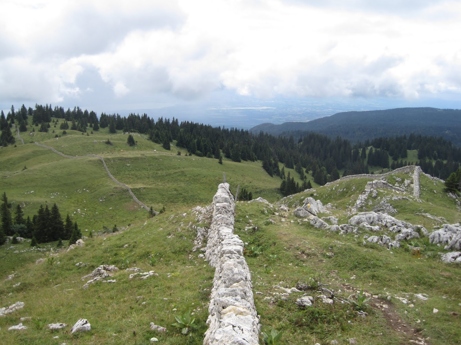
Amazing rock work on the Crest of the Juras


The signature radar station on the summit of La Dole


"Trail" on the Jura Crest heading north from La Dole down towards St Cergue 


La Dole's signature rock face


Obligatory Swiss Cow photo.


The days effort (in purple).  Click to enlarge.  4500 ft of positive vertical in 11 miles.  The route started in La Rippe.


8/1/11

Aviemore / Cairgorms - Or how i learned to pronounce my first name


A few months ago I had a  chance to visit Scotland for a conference on Alpine Meteorology.  I've always wanted to visit Scotland, so perhaps it's a case of love before first sight, but WOW!  What an amazing landscape.   Aside from the American West I've never felt a landscape move me in this manner.  There are very few trees, at least on the hills, and the endless views and climbs rolled out of before me for miles on end.  I was in Aviemore, outside of the Cairngorm National Park for the better part of a week, and managed a run up the Craigelachie's, up Geal-Charn-Mor, and finally up Cairngorm itself (webcam).  Due to weather related issues I did not manage Ben Macdui (Scotland's 2nd highest peak).  I didn't mind.  The weather was terrible/average.  That is,  the blowing snow at 40+ mph did not seem out of the ordinary at all to the rangers at the station.  The people were so friendly, and the country felt comfortably rough around the edge.

I stopped by the ranger station on the way up the summit to Cairngorm and asked the rangers about some natural features on the topo map.  

'Ummm, this one, what exactly is that?'.  

'Oh cuuhhhreeeaaag, thats a bunch of rocks.'  

'Oh really, because my name is Craig'.  

'What?  Youre name is what?'.   

'Craig'.   'No it's Cuhhhreeeaagggg'.  

Point of the story is that, at the ripe age of 33, I finally learned the proper pronunciation of my first name .... In Gaelic it's spelled differently, with an exotic and exciting combinaton of vowels!  Long story short, I've almost never seen a landscape that moved me as much.  The landscape seems so infused with the culture. It's amazing and I cant wait to return ... hopefully on a sunny day.


What is a Craig 


 Cairngorm from the Windy Ridge trail


Really nice rockwork


 A beatiful ribbon of trail descending Cairngorm towards Glenmore  


Descending towards Glenmore from Cairngorm


Looking back at Cairngorm from Aviemore.  The only blue sky I saw for a week.